U.S. Bureau of land management
Route 66 America's Iconic Mother Road Map & Guide
For thousands of years, Native Americans developed a network of trails from spring to spring across the High Desert to trade with tribes along the Pacific Coast. By the 1850s, the U.S. Army was building roads over/near the trails to support westward expansion. Railroads followed the trails where feasible to get access to water and supplies. New wagon roads were built to follow the railroads, and many of these roads would become routes for automobiles. The first car crossed the High Desert in 1903. However, desert’s sandy roads and steep grades were difficult for cars. In 1911, San Bernardino County built the first road for cars to cross the Mojave Desert. In 1912, the Old Trails Road, later named National Old Trails Road, was built. By 1918, it was the preferred transcontinental auto route from New York to Los Angeles. Between 1910 and 1920, vehicle ownership grew from 500,000 to almost 10 million. A national highway system was needed to replace America’s disjointed network of badly maintained roads and trails. Congress first introduced legislation for public highways in 1916 (Federal Aid Highway Act). The Act was revised in 1921 and again in 1925, which finally authorized construction of a national highway system. On November 11, 1926, the Chicago to Los Angeles route, was officially designated U.S. Highway 66, more popularly known as Route 66. The route extended 2,448 miles across eight states beginning in Chicago, Illinois and ending in Santa Monica, California. The “Mother Road” was born.
Read More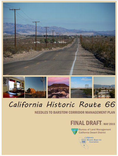
California Route 66 - Needles to Barstow Corridor Management Plan
The California Historic Route 66 Association and the California Desert District of the Bureau of Land Management (BLM) have teamed up with their governmental and nongovernmental organization partners to help preserve the history of Route 66 through the desert and develop strategies for educating visitors from both nearby and afar about its significant cultural and natural landscape features. The effort will also look for ways to increase economic activity through enhanced recreation and heritage tourism opportunities for visitors to its gateway communities. The BLM hired a multidisciplinary team led by Lardner/Klein Landscape Architects (L/KLA) to assist with this planning effort. L/KLA has prepared corridor management plans for byways and heritage touring routes throughout the United States. One of the first project tasks is to reach out to communities along Route 66, from Barstow to Needles, for their ideas, and suggestions as to how this effort can help to preserve and enhance the heritage and nature-based tourism opportunities that are found along the corridor and in the region.
Read MoreThe Official Federal Land Records Site
The BLM was established in 1946, but its roots go back to the years after America’s independence, when the young nation began acquiring additional lands. At first, these lands were used to encourage homesteading and westward migration. The General Land Office was created in 1812 to support this national goal. Over time, values and attitudes regarding public lands shifted, and President Harry S. Truman, by means of a government reorganization, merged the GLO and another agency, the U.S. Grazing Service, creating the BLM.
Read More